

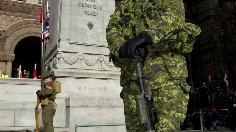

A quiet Toronto street can look ordinary until you learn that someone who died in the Second World War once lived in the house beside you. An interactive map turns thousands of City record cards into address pins. Some pins contain one name. Others contain several people from the same rooming house, apartment, institution or family address.
Our verdict: this is one of the most powerful Toronto history maps online because it puts war loss on familiar blocks instead of leaving it as a number on a monument. It is also incomplete. Treat every pin as a starting point for research, not a perfect roll of every Toronto person who died.
The best way to use it is to search your street, open one name, then verify that person through Veterans Affairs Canada and Library and Archives Canada. The biggest mistake is reading a present-day map as if Toronto's streets, boundaries and addresses have not changed since the 1940s.
Open the map
This is the public reader-created map discussed in the article. A pin is an address record, not an exact historic property boundary. Open the full map.
The public Google My Map is titled "Toronto Second World War casualty map." Its current downloadable file contained 3,121 address placemarks when checked on September 1, 2026. A placemark can contain more than one person, so pin count is not casualty count.
The original project drew on more than 3,300 typed index cards created by the Toronto City Clerk's office and preserved by the City Archives. Those cards helped form Toronto's Book of Remembrance.
Veterans Affairs Canada says the Golden Book of Remembrance contains more than 3,400 names of Toronto servicemen and servicewomen who died between 1939 and 1945.
Those three numbers describe different things. Do not force them to match.
What a pin can tell you
A map entry may include:
- residential address
- full name
- rank
- date of death
- service branch
- regiment, ship or unit
- theatre, country, battle or cause information when recorded
- a link to search the Canadian Virtual War Memorial
For example, the current pin at 1097 Yonge Street lists three people: Gunner George Notman, Lance-Sergeant George Wilfred Morrison and Private Herbert Morrison. The entries record different dates and circumstances.
At 1274 Lakeshore Road, a historical address note explains that the address and map location are correct for the period. Its pin also contains several people.
At 2129 Gerrard Street East, the entry includes RCAF members and a Royal Canadian Navy motor mechanic.
These examples show why the map is not only a field of identical poppies. One address can open several different war histories.
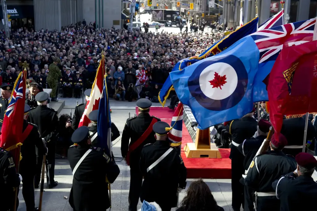

Where the information came from
The City Clerk's office created typed index cards for Toronto war casualties. The cards recorded names and local addresses. They are now held by the City of Toronto Archives.
Historian commentary published by ActiveHistory.ca in 2010 described Patrick Cain's work coding more than 3,300 cards onto a contemporary Toronto map. Readers also contributed omissions.
The map combines archival data with modern geography. That makes the history understandable, but it also introduces uncertainty. A 1943 address may no longer exist or may map to a modern point that only approximates the original lot.
Why the map feels different from a memorial
A book or stone monument gathers names in one ceremonial place. The map sends each name back into the city.
You see clusters along old streetcar routes, main streets and dense working neighbourhoods. You see apartment addresses that hold several entries. You see outer areas that were separate municipalities or less developed during the war.
The map does not make one form of remembrance better. It changes the question from "how many died?" to "who left from this block and did not return?"
How to search your own street
- Open the full map.
- Use the map search for your street name without the house number.
- Try older and current spellings.
- Zoom out if the search gives no result.
- Open nearby pins one at a time.
- Record the name, rank, date and unit.
- Follow the official memorial search link.
- Search the war-dead service file at Library and Archives Canada.
- Check historical directories and fire insurance plans for the address.
- Save your sources separately from your interpretation.
Start broad. "Lakeshore" and "Lake Shore" may behave differently. A road may have been renumbered after municipal amalgamation or redevelopment.
How to research one person properly
Step 1: Canadian Virtual War Memorial
Search Veterans Affairs Canada by surname and given names. Confirm service number, unit, date of death and memorial or cemetery.
Common names can produce several results. Do not select the first one because the rank looks right.
Step 2: Library and Archives Canada
The Second World War Service Files database covers people who died between 1939 and 1947 in service-related circumstances. Files for the war dead are open without privacy restriction.
Use name, branch, approximate birth details, unit and service number. A service file can contain forms, next-of-kin information, medical records, postings and correspondence. Content varies.
Step 3: Commonwealth War Graves Commission
Use the official casualty database to confirm burial or commemoration details. A person with no known grave may appear on a memorial.
Step 4: City directories
Toronto directories can show who lived or operated a business at an address in a particular year. Directory entries have gaps and often centre the male head of household, so absence is not proof.
Step 5: Newspapers
Death notices, casualty lists, school news and local columns can connect the service record with a family and neighbourhood. Search several spellings and initials.
Do not repeat a newspaper error without comparing the official file.
Why addresses can be wrong or confusing
Streets changed names
Toronto removed duplicate street names as municipalities grew and amalgamated. A 1940s street can now have another name.
Numbers changed
Lots were divided, houses removed and buildings replaced. A modern map may place an old number in the middle of a condo, road or park.
Toronto was smaller
Today's City of Toronto includes former municipalities that were separate during the war. The source cards may reflect the old City Clerk's administrative scope rather than every person within today's boundary.
The address may be next of kin
The card may use a family or contact address rather than the person's last everyday home. Military records can list birthplace, enlistment place and next of kin separately.
One pin can hide several people
Counting symbols undercounts names when an address contains multiple entries.
Geocoding can guess
Automated mapping converts text to coordinates. A correct text address can still land on the wrong present-day point.
Our rule: trust the card transcription as evidence to investigate. Verify the actual historical lot before stating "this exact house."
What the map leaves out
No historical dataset is neutral. Missing cards, changed boundaries, inconsistent spellings and eligibility rules shape what appears.
Women served and died, but their small number in some military records can disappear in a male-dominated visual field. Merchant sailors, civilians, allies, refugees, enemy aliens, Indigenous service members and people whose relationship to Toronto was not captured may be absent or hard to see.
Racialized residents can be underrepresented or described through flawed period categories. The absence of a pin does not mean a community made no sacrifice.
The published map also invited corrections from readers. That is a strength and a warning. Collaborative history can recover names, but contributions still need sources.
What the map cannot tell you by itself
It cannot explain why someone enlisted. It cannot show whether a family supported the war. It cannot capture grief, trauma, disability or the lives of those who returned.
It also cannot make one casualty more important because the current house is expensive, photogenic or close to your own.
A map privileges place. A service file adds biography. A unit diary adds military context. Family records add a human voice.
Use all of them when possible.
How to read clusters without making bad claims
A dense group of pins may reflect population density, working-class housing, a large apartment, military recruitment networks or better surviving records. It does not automatically prove one neighbourhood had a higher casualty rate.
To compare neighbourhoods fairly, you need:
- clear historical boundaries
- population by age and sex
- number who served
- consistent casualty definition
- address coverage rate
- treatment of multi-person pins
Raw dot density is powerful visual evidence. It is not a rate.

Twenty street-level questions worth asking
Use these prompts anywhere on the map:
- Does the old building still exist?
- Was the address a house, apartment, institution or rooming house?
- How many names share the pin?
- Were any names from the same family?
- Which military branch appears most?
- Did the person die in combat, training, accident or illness?
- Was the date tied to a known battle?
- Where did the unit serve that month?
- Where is the person buried or commemorated?
- Was the person born in Toronto?
- Where did they enlist?
- Who was listed as next of kin?
- Which school, workplace or faith community did they know?
- Does a local honour roll include them?
- Did the street have another name?
- Is the modern pin on the correct historical lot?
- Does the City directory confirm the household?
- Did a newspaper correct or misspell the name?
- Does the service file change the map summary?
- What part of the person's life is still missing?
These questions turn a quick click into real local history.
A responsible neighbourhood walk
Choose five pins within a short route. Research the names before leaving. Walk on public sidewalks and do not photograph residents through windows.
The current home is not a museum. Do not knock on a stranger's door and expect family history. Do not place a sign, poppy or object on private property without permission.
Use a notebook or audio memo. At the end, visit a public memorial, library or archive instead of turning the walk into content about private houses.
Can teachers use the map?
Yes, with context. Give each student one address or name and require two primary or authoritative sources beyond the map.
Teach the difference among casualty, service member, veteran and civilian. Discuss why the dataset exists and who may be missing.
Do not ask a child to rank sacrifices or turn deaths into a points game. The goal is research and empathy.
How to suggest a correction
First collect evidence. A correction should include the current map entry, proposed change and a source such as a service file, City directory, archival card or official memorial record.
The old OpenFile project is no longer the obvious active contact path. Preserve your research and ask the City Archives or map owner about the current correction process before assuming an edit will be made.
Do not change a location because the modern pin "looks wrong" without historical address evidence.
Visiting the Golden Book of Remembrance
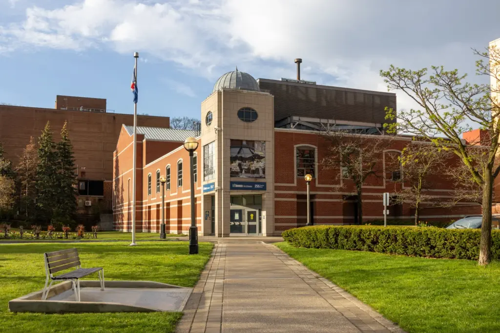
Veterans Affairs Canada says Toronto's Golden Book was dedicated on December 28, 1947 and is normally housed at the City of Toronto Archives at 255 Spadina Road.
Check the Archives' current hours, access rules and display status before visiting. "Normally housed" does not promise the book is on public view every day.
The book contains more than 3,400 names. The map and book should be understood together, not treated as competing totals.
Our final way to use the map
Search the street you know best. Pick one name. Confirm the person in the official memorial and service file. Learn what the address looked like in the 1940s.
Do not stop at the pin. The pin is where the research begins.
Keep exploring Toronto
- Five landmarks from Toronto's history and culture
- Six Toronto museums worth seeing
- Twelve underrated Toronto neighbourhoods worth exploring
Official pages to check
Prices, rules, hours and project details can change. Check these primary pages before you spend money or make a special trip:
- Toronto Second World War casualty map
- Downloadable KML inspected September 1, 2026
- Veterans Affairs Canada, Golden Book of Remembrance
- Library and Archives Canada, Second World War research
Frequently asked questions
How many Toronto Second World War casualties are on the map?
The current downloadable map file contained 3,121 address placemarks when checked on September 1, 2026. Some pins contain several people, so that is not a casualty total.
Where did the map data come from?
It came from more than 3,300 typed index cards created by the Toronto City Clerk's office and now held by the City Archives. Readers also contributed corrections and omissions.
Why does the Golden Book have more than 3,400 names?
The book, card set and current map count different units. Map pins can contain several names, and source scope or completeness can differ.
Can I search a Toronto street?
Yes. Search the street name in the full map and inspect nearby pins. Try historical spellings and verify the lot because names and numbers changed.
Where can I find a soldier's service file?
Library and Archives Canada provides an open database for Second World War service files of people who died between 1939 and 1947 in covered circumstances.
Is every map pin exact?
No. Modern geocoding, changed streets and historical address use can create errors or approximations. Verify with City directories, maps and archival records.
Can I visit the Golden Book?
It is normally housed at the City of Toronto Archives. Check current viewing access and hours before going.
Is it respectful to visit the old address?
Yes from a public sidewalk, if you respect current residents and private property. Do not knock, enter or leave objects without permission.