


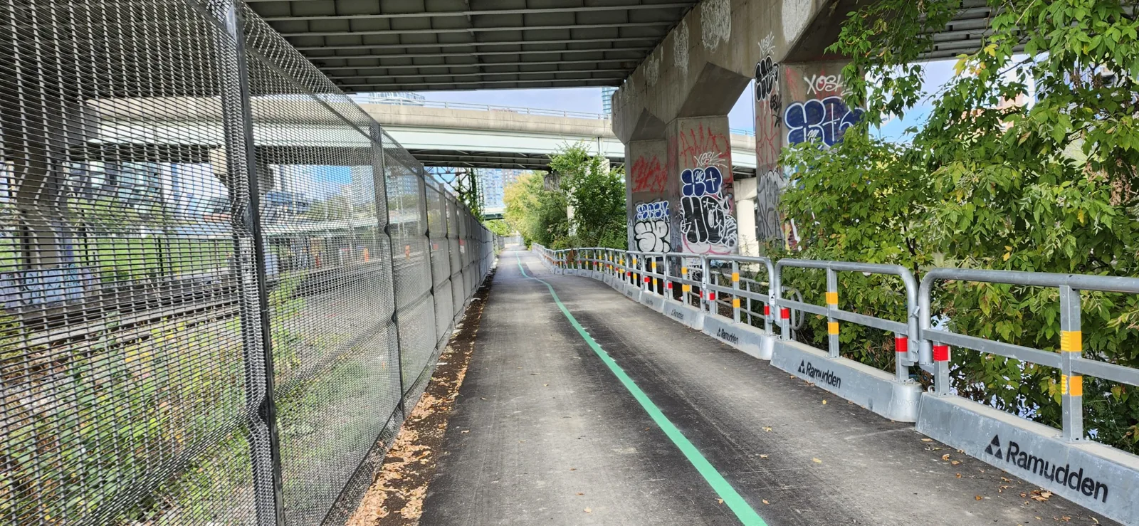
The City says the Lower Don Trail is open from Corktown Common to E.T. Seton Park. Our first choice for a short first walk is the Corktown Common end. It gives you a clear meeting point without beginning at a bridge staircase.
For a closure fallback, check the Bayview multi-use route and the latest posted detour. The deal-breaker on our October 10 check was Riverdale's new sloped path: the City still listed it as closed. Check the linked City project notice for a reopening before planning to use it. Another temporary trail closure is planned after Thanksgiving in fall 2026. Don't build a stroller trip or a timed commute around a ramp that isn't open.
Checked October 10, 2026, against the City's Lower Don Trail project page, last modified September 23. Check it again before travelling, especially after October 12.
| What you want to use | Current official position | What it means for your plan |
|---|---|---|
| Trail from Corktown Common to E.T. Seton Park | Opened August 1, 2026 | Plan a route through the open corridor, then check later closures |
| Queen Street staircase | Open | It is a stair access point |
| Dundas Street staircase | Open | Useful for a person who can manage steps; bicycle troughs don't make it step-free |
| Existing Riverdale Park Bridge staircase | Open | Separate from the new sloped connection |
| New Riverdale sloped path, north side of the pedestrian bridge | Closed | Don't plan to roll down it with a stroller, wheelchair or bike trailer |
| Further work after Thanksgiving | Temporary closure planned | Exact public start date, affected reach and duration still need a dated notice |
A social photo of an open gate is a weaker planning source than the current City notice and signs. Use a short route with a way back before committing to the full corridor.
Is the Lower Don Trail open, and what could change?
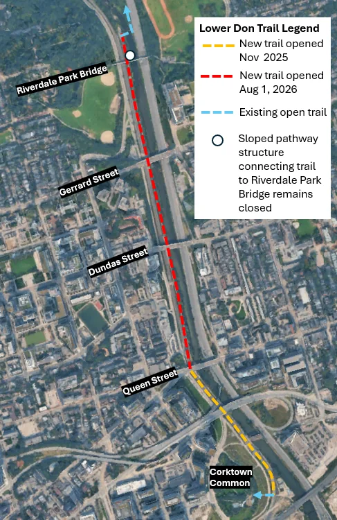
The August reopening is a real opening, rather than an old target date. The City says the trail and the Queen, Dundas and Riverdale staircases opened. It also clearly separates the unfinished Riverdale sloped path.
That distinction matters. “The trail is open” doesn't mean every entrance is usable for every person. An accessible connection under construction is still a closed connection.
The project page keeps older updates below its newest information. Its original spring 2026 target and earlier summer 2025 forecasts explain the history. They aren't today's instructions. Read the newest status first.
What isn't confirmed yet
The City plans another temporary closure after the Thanksgiving long weekend to finish the Riverdale connection. On our October 10 check, its public notice didn't give the exact start date, full affected section or duration. It says details will be posted onsite and online in advance.
October 13 is a possible start date, not a confirmed one here. Confidence is low. That date comes from an unverified account of proposed work timing. A dated City notice would confirm or replace it. Don't assume you'll have the rest of October just because the wording says “fall.”
We also aren't giving the ramp a new guaranteed completion date. Repeated old forecasts are a reason to use an actual opening notice, not invent the next forecast.
Bayview is the fallback to check
The City identifies the Bayview Avenue Multi-Use Trail, west of the railway corridor, as the alternative alignment. That is the separated route to look for. It isn't an instruction to ride in any available traffic lane on Bayview.
Read the newest detour signs for the entry and exit you need. Older maps with several kilometres coloured as closed can still circulate after a reopening. Their route layout can be useful, but their old closure dates can't settle your trip today.
Bayview is our first fallback to check if the riverside route is fenced off. It also deserves a look if your normal Riverdale access would require lifting equipment down stairs. Confirm the current connection rather than assuming a nearby path is automatically step-free from your starting street.
Choose the signed open route. Turn back at a closure. An apparently empty work area or loose fence doesn't make a shortcut public access.
Choose an entrance that fits your legs and your equipment
Corktown Common: our first pick for a short first visit
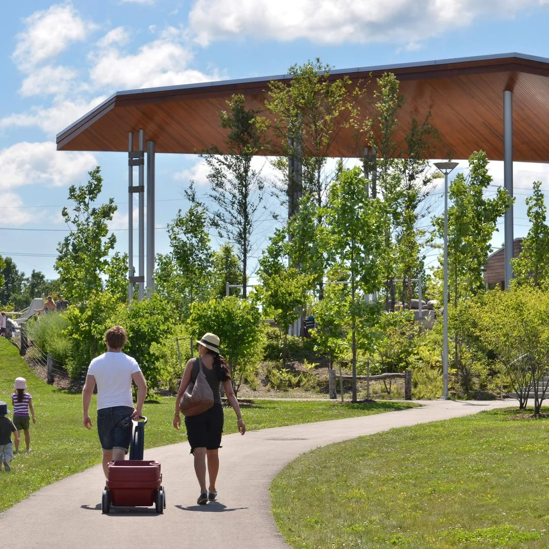
Use Corktown Common, 155 Bayview Avenue, around Bayview and Mill Street, as the southern meeting area. The Waterfront Toronto park page describes its paths and connection to the Don landscape. Check the Lower Don map for the trail connection you intend to follow.
This is the starting area we'd choose for an easy-to-understand meeting and a short out-and-back. The park gives your group a place to gather before deciding how far to go. It is a better first plan than trying to find an unfamiliar staircase from a moving bike.
For a one-hour outing, leave room for finding the connection and returning. Turn back when you've used roughly a third of your time, rather than using half the hour travelling outward and hoping nothing slows the return. That is a planning suggestion, not a measured walking time between two bridges.
The good: a recognisable southern base and a route you can shorten.
The limit: a park path isn't a full accessibility audit of the trail beyond it. Check gradients, the surface and any temporary diversion for your needs. A reopening doesn't certify that every approach from every street is step-free.
Choose this end for a first walk. Keep the longer ride for a day when you've already checked the whole route and a fallback.
Dundas Street East: useful stair access, not a ramp
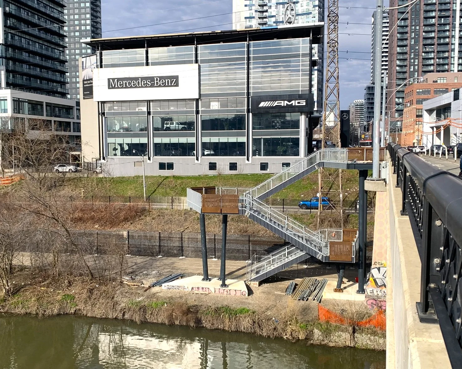
The new Dundas Street East staircase links the street bridge with the trail below. The City describes lookouts and bicycle troughs, and its current update lists the staircase as open.
A bicycle trough is a channel to help move wheels beside the stairs. It isn't a wheelchair ramp, and it doesn't remove the need to handle the bike and steps. A loaded cargo bike, trailer or awkward child seat changes the choice.
If you can comfortably use the stairs, this is a practical way into a shorter trail visit from Dundas. If you can't, pick a confirmed street-level route instead of arriving and trying to solve the problem at the top.
The City also lists the Queen Street East staircase as open. Apply the same rule: decide whether stair access works before travelling there. Use the official map and signed access; don't treat a road bridge barrier as an entrance.
Choose Dundas for stair access. Skip it as your default stroller or wheelchair entry. The new structure doesn't change what stairs are.
Riverdale Park Bridge: the familiar connection has an unfinished part
The Riverdale Park Pedestrian Bridge connects the East and West parks. Its existing stair access to the Lower Don is separate from the new sloped structure on the bridge's north side.
The City lists the staircase as open and the new sloped path as closed. Don't read a bridge opening, a railing installation or a progress photograph as permission to use the unfinished route.
This is the weaker entry for a family that needs to roll straight down with a stroller or bike trailer. Being close to Riverdale Park doesn't solve that last connection into the valley.
The bridge approach also belongs in your planning. Coming from a nearby street or subway can still include a hill, grass or steps before the trail. Check the full route, rather than only the final pin.
Use the existing stairs if they suit you. Otherwise choose another verified approach now and save the new sloped path for an actual opening notice.
What about Pottery Road?
The corridor opening extends north beyond Pottery Road toward E.T. Seton Park. Pottery Road and Bayview are important trailhead locations, but that doesn't create a promise of convenient free parking at the roadside.
The City project page names trailhead and wetland improvements around that junction. Check the signed entrance and crossings. Don't confuse an informal vehicle pull-off, a natural-surface Crothers Woods trail or a closed work access with the paved Lower Don route.
The map links above identify meeting or access areas. They don't draw a turn-by-turn route or a park boundary. Use the City's project map and signs for the final connection.
The improved trail is still a working river corridor
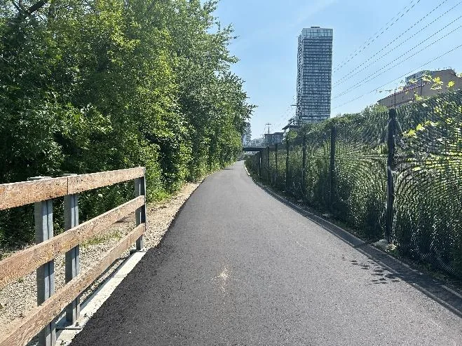
The improvements address paving, drainage, erosion, fencing and access. They don't turn the whole Don Valley into a silent forest or a uniform new surface.
The river, railway and Don Valley Parkway run close to parts of this route. Choose it for a useful off-road corridor and river scenery. Don't choose it expecting silence along every reach.
Recent repaving in one section also isn't proof that every part farther north has a perfect surface. Look ahead for puddles, debris, uneven edges and maintenance work. Slow down before a blind curve or narrow crossing, rather than trying to keep a fixed speed throughout.
An open trail isn't a weather guarantee
The City's project history describes erosion, drainage problems and floodplain conditions. Heavy rain can change the route after an opening notice was posted.
Don't enter standing floodwater or follow someone through it because their bike made it across. Turn around, choose a legal alternative and report a non-urgent trail problem through 311 with the exact location. A bridge name and direction are more useful than “somewhere in the Don.”
For a first trip, go in daylight and leave time to return. Fallen autumn leaves can cover a wet surface. An attractive leaf walk isn't a reason to ignore the trail underfoot.
Share the route without making it a race
People walk, run and ride here. Give a clear passing warning, slow down and allow room for a child, dog or person who doesn't move exactly as you expected. Stop out of the travel line when checking a map.
If you're using this for a commute, choose the route for dependable access rather than an optimistic best-case time. Check a road or transit fallback before the morning you must arrive on time. Don't turn the first unfamiliar ride into a speed test.
A bike you can handle on the path may still be difficult at a staircase. Check the entry and exit together, especially with a trailer or heavy bike.
Our verdict: the Lower Don is a worthwhile corridor when the access works. It is a poor choice for a rigid schedule without a checked alternative during this finishing work.
Want a longer Don ride? Treat the north and waterfront as separate checks
Charles Sauriol Conservation Area, with the access area at 1191 Lawrence Avenue East, is a separate northern starting option. It isn't a downtown Lower Don entrance. Use it for a longer northern outing when the route and your transport plan fit.
Parking is limited, and a space isn't guaranteed. Check current signs and don't assume the trailhead has a washroom. Carry what you need before riding into a longer stretch.
The TRCA East Don Trail project page gives a different current update: Phase 1 opened July 13, 2026, with intermittent closures still possible for finishing work. That is separate from the Lower Don's August opening and Riverdale connection.
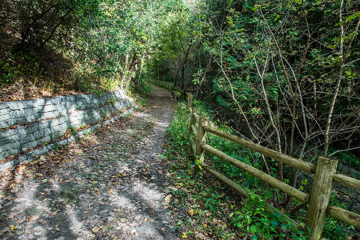
Follow the notice for the particular trail you want. “The Don is open” is too broad for several linked projects. Natural-surface woodland trails also aren't automatically the right choice for a road bike, stroller or wheelchair.
Don't assume the southern waterfront connection from an opening headline
The City's Lower Don announcement describes Corktown Common to E.T. Seton Park. It isn't a blanket clearance for every construction area south of Corktown or every waterfront link.
If you're continuing to Biidaasige Park, use the City's current park arrival guide and the signs for that approach. Check the connecting route separately before promising an uninterrupted ride to the harbour.
Our Biidaasige Park guide helps choose a park entrance and the reason to visit. It is a different outing from simply testing the reopened Lower Don reach.
For more options, see our Toronto ravines after heavy rain and public washroom guide. Check the actual facility you need rather than expecting a washroom at every staircase.
Start with a short open reach and an entrance you can use. Add the longer connection when the notices, surfaces and return route all work for your trip.
Maps for the other places mentioned
The maps below cover extra branches and supporting names mentioned in this guide. Maps labelled "Search results" do not confirm a business is open or identify a verified branch. Match the name, address and current official details before travelling. Open only the maps you need.
Map: Lower Don Queen Street staircase
Map: E T Seton Park
Search results: Crothers Woods
Search results: Taylor Creek Park
Search results: Lower Don Trail
Frequently asked questions
Is the Lower Don Trail open in Toronto?
On our October 10, 2026 check, the City lists it as open from Corktown Common to E.T. Seton Park. It opened August 1. Another temporary closure is planned after Thanksgiving for finishing work, so check the latest notice before travelling.
Is the new Riverdale Park Bridge ramp open?
No. The City's latest update says the new sloped connection on the north side of the Riverdale pedestrian bridge remains closed. The existing stair access is separate and is listed as open.
Are the Dundas and Queen Street stairs open?
Yes, the City's current project page lists both staircases as open. A staircase isn't step-free access. Check a different approach if you need to roll a stroller, wheelchair or trailer into the valley.
Where should I start a short first walk?
Our first choice is the Corktown Common end, around 155 Bayview Avenue and Mill Street. It gives you a clear southern meeting point for a short out-and-back. Check the signed trail connection and your access needs before setting off.
Can I use Bayview when the Lower Don is closed?
The City identifies the Bayview Avenue Multi-Use Trail west of the railway as an alternative alignment. Follow the current posted detour for your entry and exit. That isn't permission to bypass a barrier or use a traffic lane as an improvised path.
Does the fall closure definitely start October 13?
We haven't confirmed that exact date from a public City notice. Its current wording says after the Thanksgiving long weekend. Check the project page and onsite notices for the start, affected section and duration.
Does a bicycle trough make the Dundas staircase accessible to wheelchairs?
No. The trough helps move bicycle wheels beside the steps. It isn't a ramp. Choose a verified step-free approach instead.
Is Charles Sauriol part of the same downtown entrance route?
No. Charles Sauriol is a northern starting option at the Lawrence Avenue East access area. Its connected East Don projects have their own notices and intermittent closure information. Check those separately before planning a longer ride.