


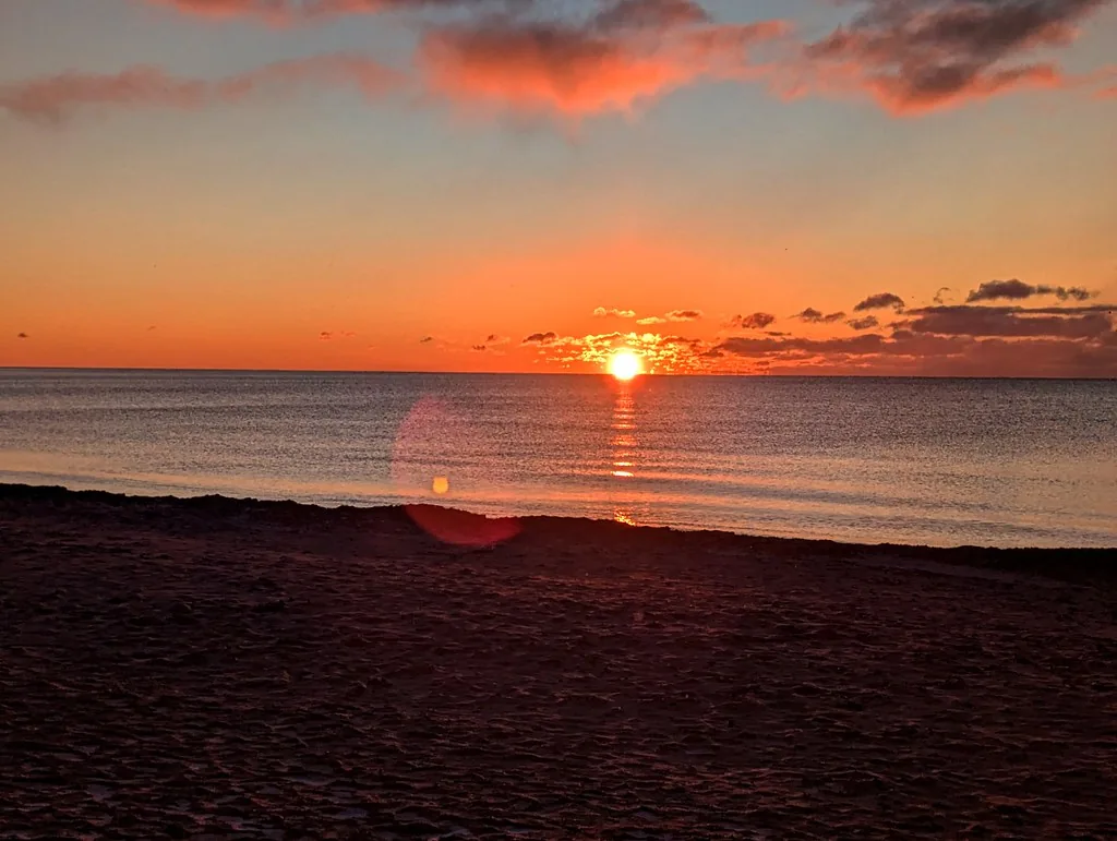
Woodbine Beach is our best first choice for sunrise photos in Toronto. You get room to move along the shore and several ways to frame the lake. Riverdale Park East is the easier choice for a downtown skyline at dawn, especially if the Beaches trip is too far.
The main catch is direction. A pink skyline and the sun rising above water are different pictures. The other catch is access. Skip Tommy Thompson Park on a weekday morning. Its official public opening time is 4 p.m. on weekdays.
This guide helps you choose the picture first, then plan the route. Access details were checked on October 9, 2026. No spot can promise the same colours as a photograph you saw online.
Which sunrise picture are you trying to take?
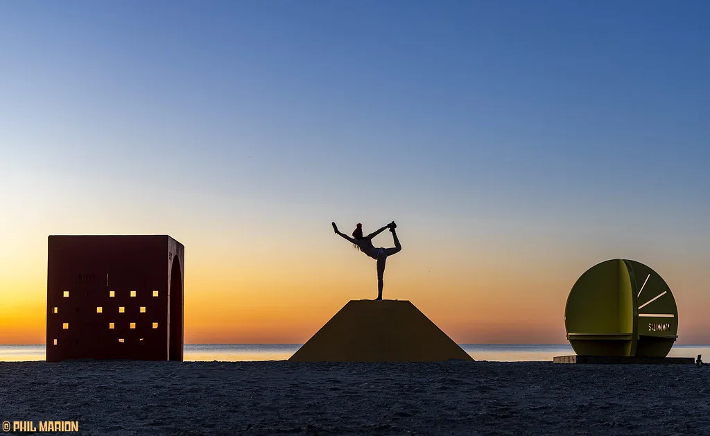
For the sun itself, you need a clear view toward its rising direction. For a skyline at dawn, you may face away from the sun and photograph soft light on the city instead.
At the Beaches, downtown is west of you. A pastel Toronto skyline from Woodbine is not proof that the sun rises behind the CN Tower from that spot. Look at the direction before choosing a composition.
If a photograph includes a sculpture or another foreground feature, check that it is still there before planning the same frame. An older beach image is not a current inventory of the shore.
| The picture you want | Our choice | The trade-off |
|---|---|---|
| Lake, sky and room to try several frames | Woodbine Beach | The sun's position changes with the season |
| A skyline without a long shoreline walk | Riverdale Park East | Strong city view, weaker for a clear rising-sun horizon |
| Architecture beside the lake | R.C. Harris exterior grounds | Working facility, with slopes and steps |
| A west-end shoreline visit | An open part of Humber Bay Park West | Current construction limits the usual route |
| Birds, lake and a longer walk in Etobicoke | Colonel Samuel Smith Park | Check shoreline works and detours |
| A longer nature outing | Tommy Thompson Park on an eligible weekend or holiday | Gate time and walking distance can defeat an early plan |
Choose one main view. Don't spend the useful light travelling between two places across the city.
Woodbine Beach: our best place to start
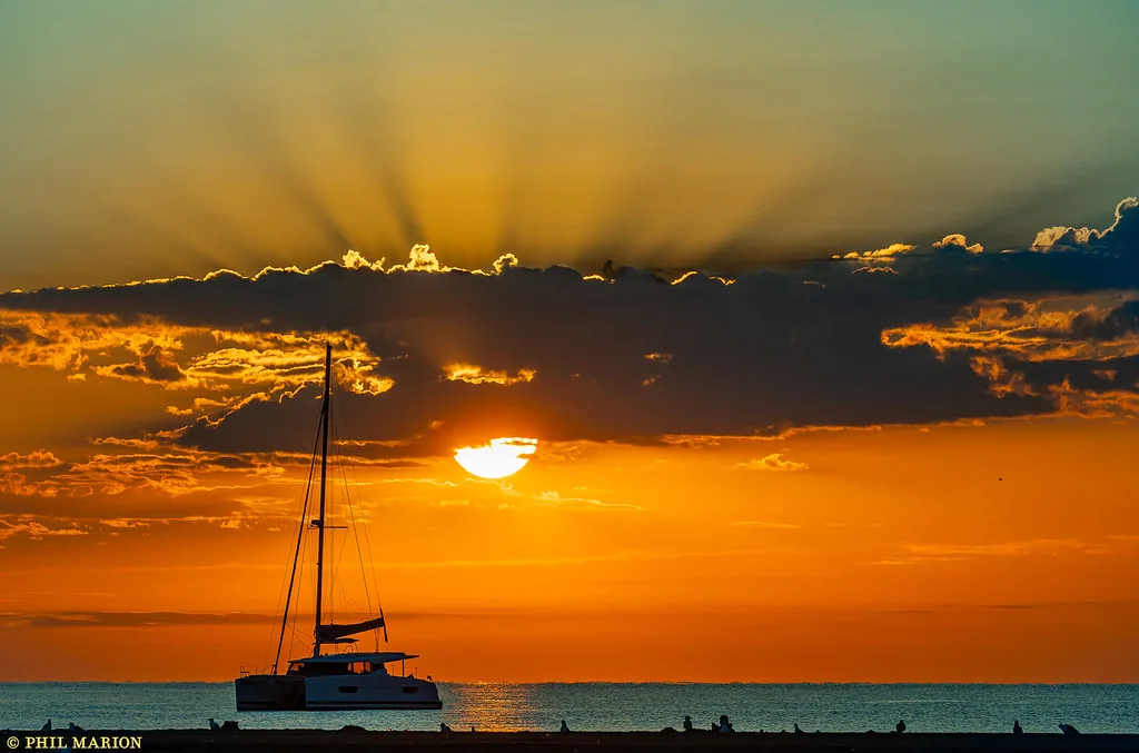
1675 Lake Shore Boulevard East, at the south end of Woodbine Avenue. The City's beach information is a useful starting point for facilities and seasonal beach services.
Why it wins: a wide shore gives you more choice than one cramped lookout. You can frame water, sand and sky, then move a little when the light changes. You don't need an elaborate hike to make the first visit worthwhile.
For a direct sunrise, check the bright part of the eastern sky. Don't assume the sun will rise over open water from every point on the beach in every month. Summer and winter put it in different places.
For the skyline, look west. A longer lens or your phone's usable zoom can help frame the distant city, but avoid zooming so far that the picture becomes soft. Take a wider frame as well.
The drawbacks: the lakefront can feel colder and windier than the street you left. Sand is awkward for some mobility aids, and an early visit does not guarantee an open washroom or a lifeguard on duty. This is a shore-photo plan, not a sunrise swim recommendation.
Without a car: the 301 Queen night streetcar serves the Queen Street corridor overnight. Check its stop at Woodbine and the current service alerts, then allow time to walk south. Don't plan from the regular subway timetable alone.
The boardwalk toward Kew and Leuty gives you another way to frame the same morning. If you add that walk, keep it close enough that you aren't hurrying through the best light to reach a second landmark.
Choose Woodbine for your first lake sunrise. Stay with the light you find, rather than chasing an exact copy of someone else's photograph.
Riverdale Park East: choose it for the skyline, not the sun over the lake
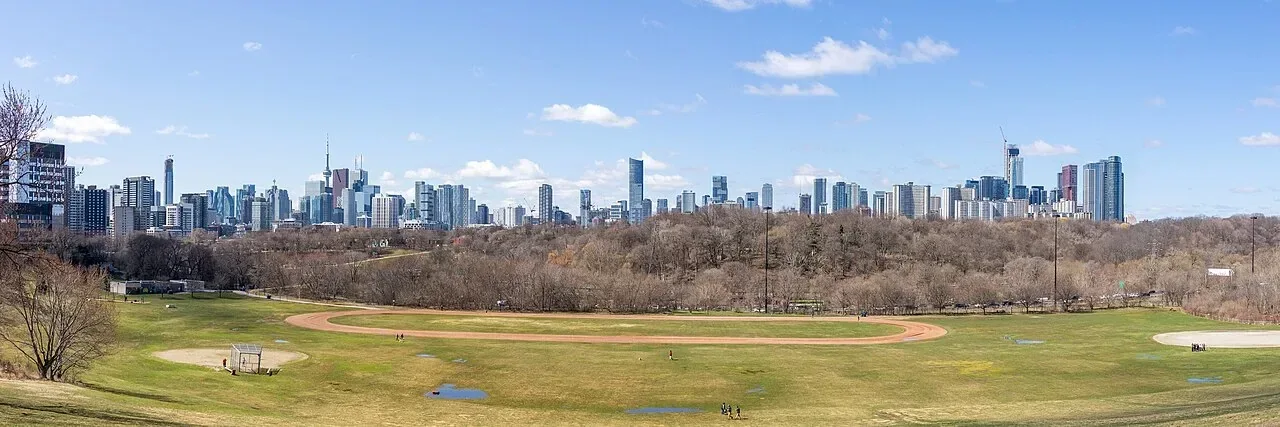

550 Broadview Avenue. Start near the top of the hill beside Broadview, rather than walking down into the valley and then discovering the view is behind you.
The good: the downtown skyline is the subject. You can make a clear city photograph without needing a long walk out onto a peninsula. The upper edge also lets you keep the visit shorter.
The weaker part: this famous view faces toward downtown to the west. It is a better fit for skyline colour at dawn than for watching the sun appear directly behind the city. If the sun's disc over water is the picture you want, choose Woodbine instead.
The City's lookout project page places future improvements beside Broadview. Its current timetable aims for construction in 2027. Don't expect a completed new viewing platform from that plan today.
The slope is a real drawback in wet or icy conditions. Keep to a route you can manage, and don't assume a steep grassy descent is a suitable shortcut for everyone.
Without a car: plan your TTC arrival to the Broadview side for the actual date and time. Leave enough time for the final walk to the upper edge. A nearby subway station does not mean subway service has started before sunrise.
Choose Riverdale when the skyline matters most. Skip it for a clear lake horizon and go to the shore.
R.C. Harris: the best architecture-and-lake choice
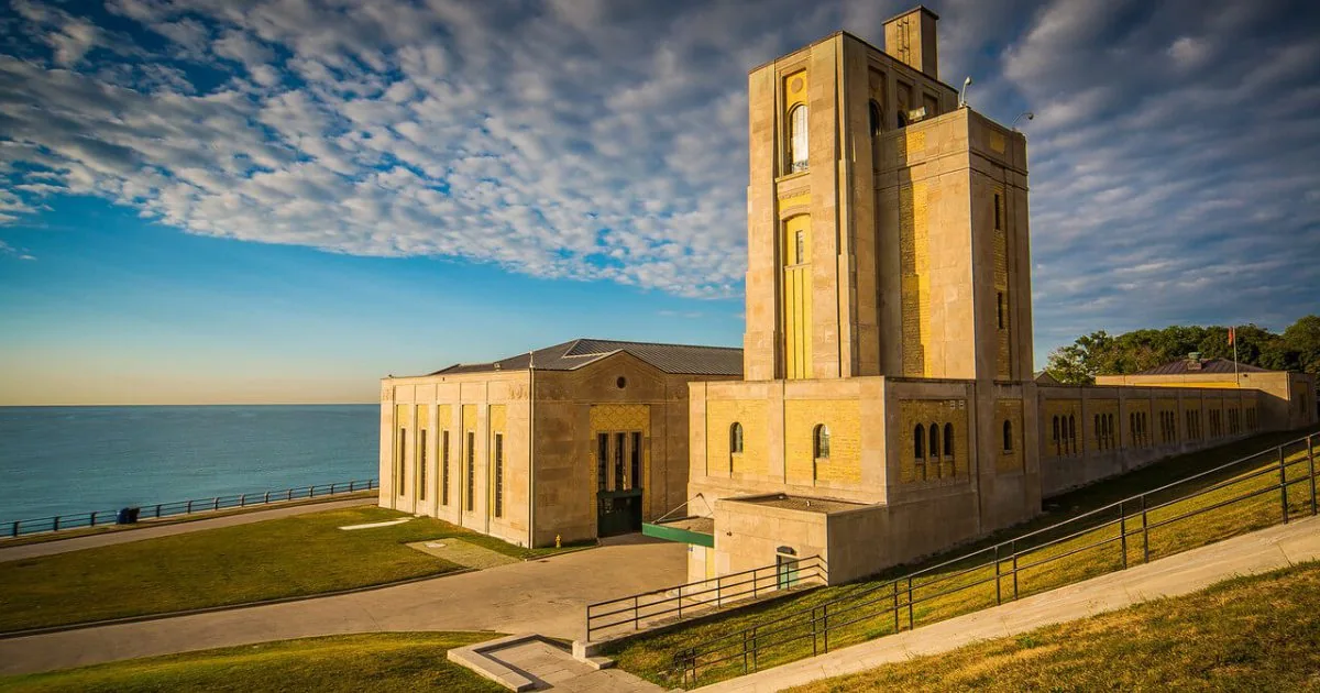
The R.C. Harris Water Treatment Plant, at 2701 Queen Street East, adds large stone buildings and stairs to an east-end shoreline photograph. Its Art Deco style uses strong shapes and careful symmetry, which can give a picture a more definite subject than sky alone.
The good: you can compare a lake view with an architectural frame in the same area. It suits a reader who wants a building, person or strong shape in the foreground.
The limit: this is a working water facility, not an open museum every morning. Use the public exterior areas, respect gates and signs, and do not plan an indoor visit from a past Doors Open listing.
Doors Open Ontario's facility listing is useful for the location and building context. A scheduled open-house event and an ordinary dawn visit are different things.
The grounds include slopes and steps. Rock edges beside the water are not a shortcut to a better photograph. Stay on a stable route and keep away from waves or ice.
Without a car: check the 301 Queen route to the Neville Park end and the last walking section. Confirm current diversions before relying on that approach. This is a longer east-end trip than getting off at Woodbine.
Choose R.C. Harris for architecture as well as morning light. Choose Woodbine if you want the simpler beach visit.
Humber Bay Park West: good potential, but construction changes the choice
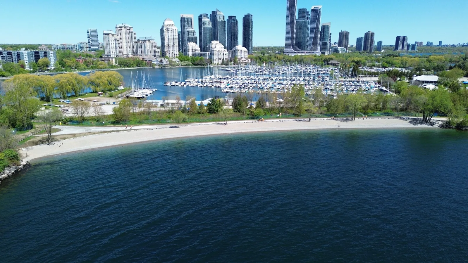
The west waterfront offers a different relationship to downtown. You are looking back toward the city from the west, rather than looking west from the Beaches. That makes it a useful direction to compare for morning skyline light.
But Humber Bay Park West is not a blank promise of open shoreline right now. The TRCA maintenance page says Phase 1, including the south beach and dog off-leash area, is complete and open. Phase 2 work on the Etobicoke Point headland and central beach continues, with expected completion in December 2026.
Its October 6 update still reports work placing pebbles and large protective rocks. Don't use an old photo to choose a route through a current work area, even before the crews arrive.
The useful choice: use the current access map and an open path that suits your photograph. If the blocked section is the reason you wanted to come, choose another shoreline rather than trying to get around a barrier.
Humber Bay Park East is a separate peninsula with its own work and access limits. The City's Humber Bay plan page is the place to check those. “Humber Bay” in a caption does not tell you which side is open.
Without a car: plan to the Lake Shore Boulevard West and Legion Road area, then check the open pedestrian route. Use the TTC planner for the service operating at your early arrival time. Don't assume an older daytime streetcar route description applies overnight.
Choose an open West route if you already know the area. For an unfamiliar first sunrise trip during construction, Woodbine is the simpler decision.
Colonel Samuel Smith Park: a western option that needs a detour check
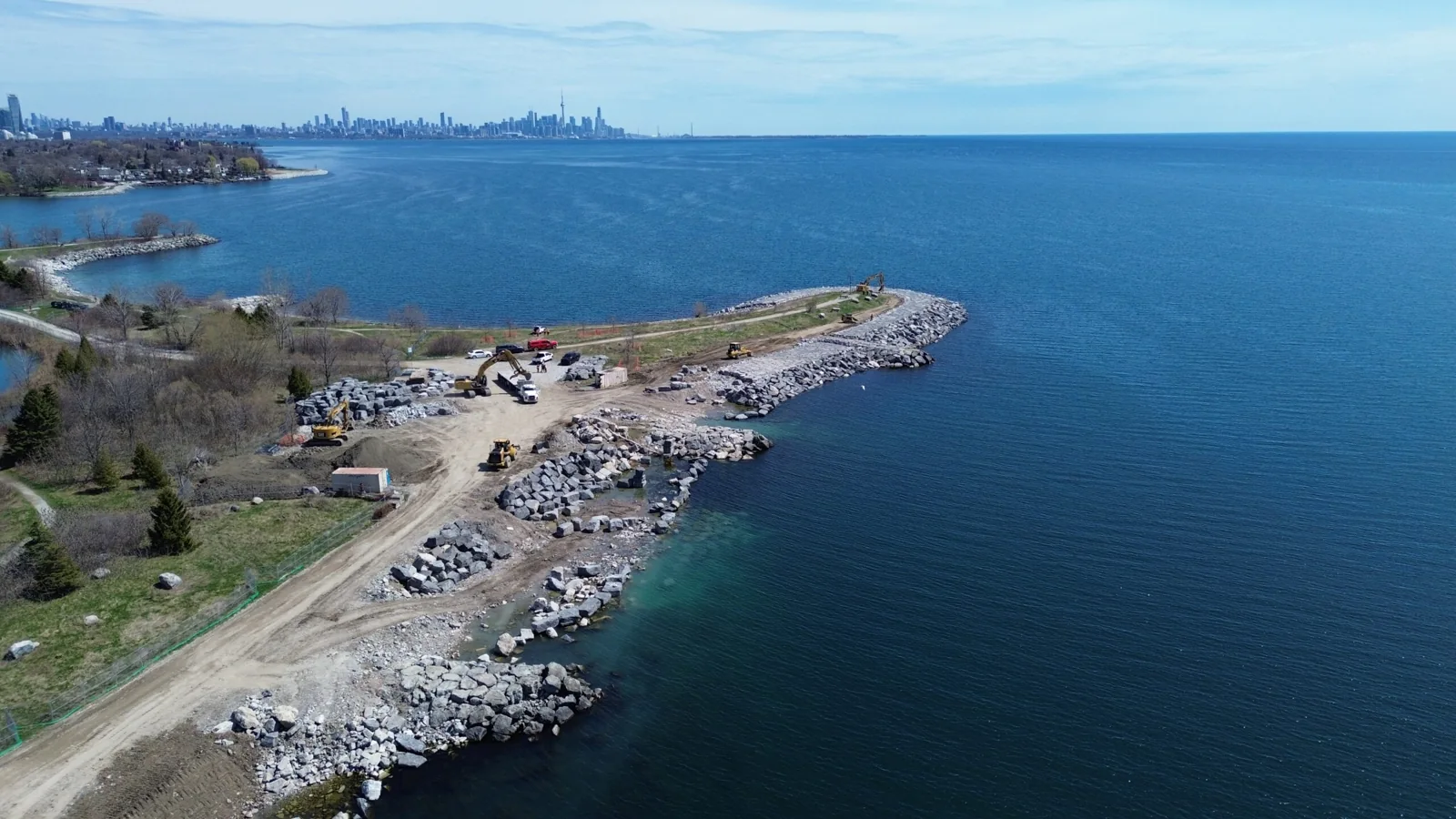
3145 Lake Shore Boulevard West, near the Humber College Lakeshore area. This is a useful western alternative when getting all the way to the Beaches would defeat the point of an early visit.
The park gives you lake and shoreline subjects, with bird habitat adding interest after the first light. You don't need to make the distant skyline the subject of every Toronto photograph.
The drawback: current TRCA shoreline restoration information includes trail closures and a construction access route. Some sections are available outside work hours or on weekends, while other sections remain restricted. Read the actual detour map.
Do not treat “after work hours” as permission to enter every fenced area. The current notice and barriers decide the usable route. A first-time visitor should work that out in daylight rather than improvise it before dawn.
Without a car: check your trip to Lake Shore and the final walk into the park. The overnight Queen route serves the western lakefront corridor, but your last stop and walking approach still need planning.
Choose this if it is your nearby western park and the open route fits. Skip an unfamiliar construction detour solely to copy a sunrise photo.
Tommy Thompson Park: an eligible weekend or holiday plan only
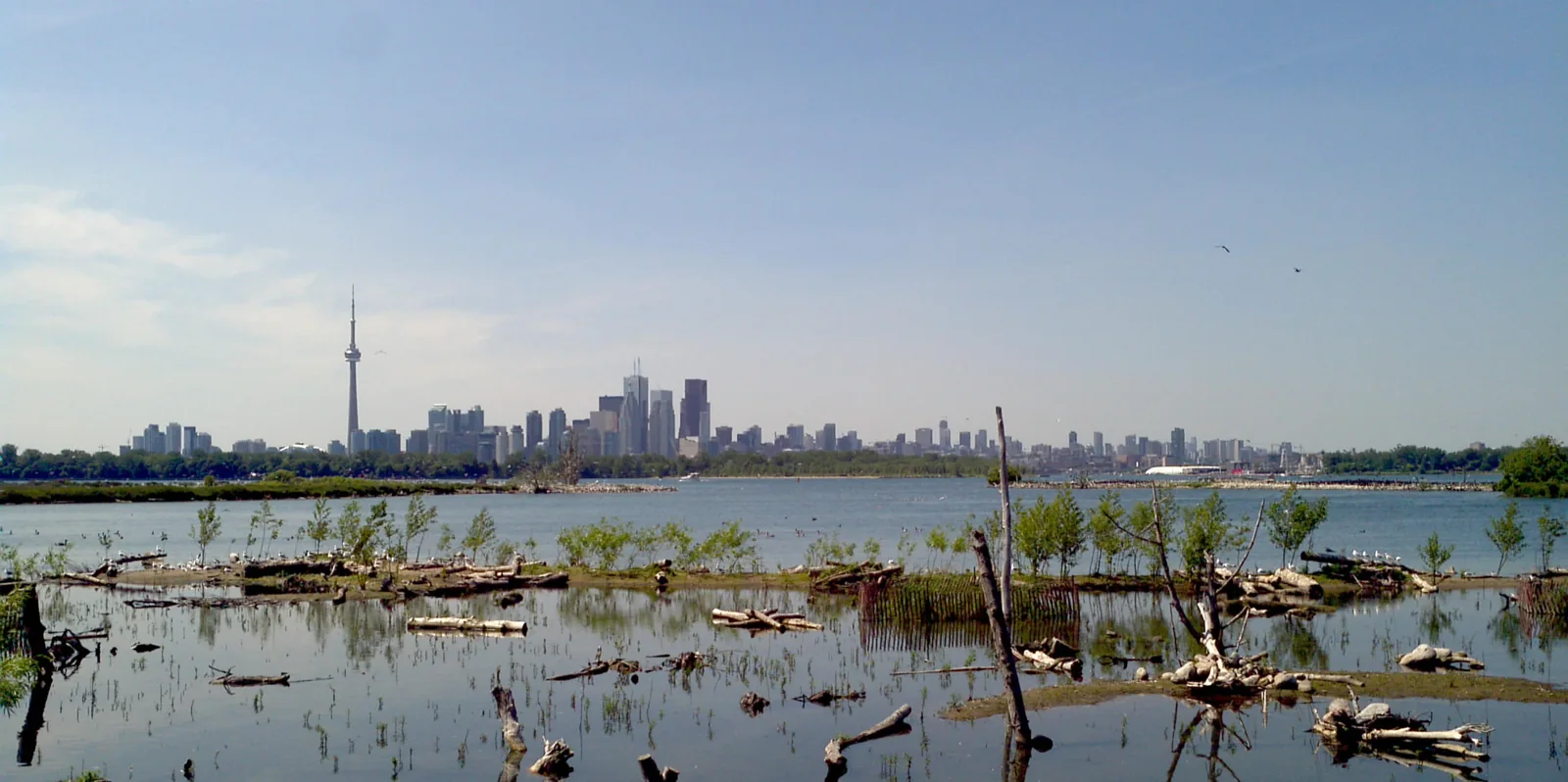
The official visitor information lists public hours as 4–9 p.m. on weekdays and 5:30 a.m.–9 p.m. on weekends and holidays. It clearly says the park is closed to the public on weekdays until 4 p.m.
That rules out a normal weekday sunrise trip. A social post or an older sunrise list does not change the gate hours.
On an eligible weekend or holiday, this is a longer nature outing. Choose a view you can reach after the gate opens. An early summer sunrise gives you less walking time after 5:30 than a later autumn or winter sunrise.
The other limit: the Nature Centre opens later than the park. The current page lists 11 a.m. as its opening time on weekends and holidays. Don't count on its services during the dawn part of your visit.
There are current trail notices, including the closed northern Embayment D section and weekday closures of the pedestrian bridge during dredging works. Check the park's notices and don't assume a favourite loop is fully usable.
The official FAQ also identifies Christmas Day, Boxing Day and New Year's Day as holiday exceptions. Check the date rather than treating every holiday as an identical visit.
Choose it for a longer, checked weekend outing. For a quick first sunrise or a weekday morning, use another spot.
Plan the time, transit and photograph together
Start with the sunrise time for your date. The National Research Council sunrise calculator is a useful reference. Check the location and time setting rather than copying a time from last month's photo.
You can aim to arrive before sunrise for softer light, but opening hours come first. The City's published Parks Code sets a general overnight restriction from 12:01 a.m. to 5:30 a.m. unless authorized by permit. Specific site hours and closures also apply.
That matters most for very early summer plans. An attractive photograph taken before dawn is not proof that its exact route or arrival time was available to the public.
Use the TTC trip planner with an arrival time, then add the final walk. Check alerts and the return trip too. The Blue Night network is useful when the subway has not started, especially on Sunday mornings.
If cycling suits the route, our Bike Share Toronto guide explains the service and costs. Plan the docking point and final walk as carefully as the ride.
Keep the first plan simple: one view, a walking route you understand and enough time for a delayed vehicle. A faraway “best spot” is worse than a nearby good view if you miss the light getting there.
A few photo choices that make the morning easier
Take a wide frame before committing to a close crop. Keep the horizon straight, and try a little foreground such as shore, a building or a path. Don't block a shared path while setting up.
If a phone makes the bright sky look washed out, reduce the exposure a little and compare another frame. Keep a brighter version too. You can decide later which one holds the colour best.
The useful picture may happen before the sun appears or shortly afterwards. Don't leave as soon as the first frame disappoints you. Also don't stay on a wet edge or closed trail because you think the next minute will fix everything.
Dress for standing still beside the lake, not just the walk from the stop. Bring a charged phone, a dry place for the camera and a simple return plan. Wind, cold and a long wait are the real cost of an early photo trip.
Breakfast and washrooms are a separate check
Don't assume a beach washroom, park building or café is open when you arrive. Use the facilities before setting out if you can, and check a business's actual opening time before relying on it.
After a Beaches visit, Queen Street East is the useful street to look along. After Riverdale, compare Broadview and the Danforth. In the west, plan around Lake Shore Boulevard rather than adding another long cross-city trip for breakfast.
Our early-morning Toronto guide helps with the rest of the outing. For a longer warm-weather visit, compare our Toronto beaches that don't need an island ferry.
Choose the food stop after choosing the photo location. A place with good reviews at 10 a.m. may be no help at 6:30. If nothing suitable is confirmed open, bring a drink or snack instead of making the whole morning depend on it.
Pick the view you can reach, respect the open route and keep breakfast flexible. That is a better first plan than trying to collect every famous lookout in one morning.
Other photo leads that are not confirmed for this plan
Beare Hill and the Islington Avenue bridge over the rail corridor near New Toronto are further leads from older photo advice. As of October 9, 2026, we have low confidence in recommending either as a checked early-morning route. We have not verified the current public walking approach, hours or exact view for this guide.
A current City access notice or a verified public route would change that assessment. Until then, choose one of the places above instead of planning an unfamiliar trip around a brief old recommendation.
Maps for the other places mentioned
The maps below cover extra branches and supporting names mentioned in this guide. Maps labelled "Search results" do not confirm a business is open or identify a verified branch. Match the name, address and current official details before travelling. Open only the maps you need.
Map: Main Street Station
Map: Woodbine Station
Map: Broadview Station
Map: Jane Station
Map: Kipling Station
Search results: Beare Hill
Search results: Islington Avenue bridge New Toronto
Frequently asked questions
Where is the best place to photograph sunrise in Toronto?
Our first choice is Woodbine Beach because the shore gives you room to try different frames. Riverdale Park East is our alternative for the downtown skyline at dawn. Choose the picture you want before choosing the route.
Can I see the sun rise behind the downtown skyline from Woodbine?
Downtown is west of Woodbine, while the rising sun is in the eastern part of the sky. A pastel skyline there is a different composition from a direct rising-sun photograph. Look west for the city and check the eastern horizon for the sun itself.
Is Riverdale Park East good for sunrise or sunset?
Its west-facing skyline view is a strong fit for sunset and for city colour at dawn. It is weaker if your goal is seeing the sun rise over an open lake horizon. Choose Woodbine for that kind of morning.
Can I visit Tommy Thompson Park for a weekday sunrise?
No. Its current official public hours begin at 4 p.m. on weekdays. Weekend and eligible holiday access starts at 5:30 a.m., with specific holiday exceptions and current trail notices to check.
Is Humber Bay Park West fully open for sunrise photos?
No blanket promise is justified. TRCA says its completed Phase 1 areas are open, while Phase 2 work continues around the Etobicoke Point headland and central beach. Use the current access map and stay out of fenced work areas.
Can I reach Toronto sunrise spots on the TTC?
Yes, but plan for the actual early arrival time. The 301 Queen night route is useful for the Beaches and western lakefront corridor. Check the final walk, alerts and whether the subway has started before relying on a regular daytime trip.
How early should I arrive for sunrise photos?
Give yourself time to find a frame before the sun appears, while respecting the site's opening time. Check sunrise for your exact date and add the walk from the stop. A fixed “arrive at 6” rule does not work all year.
Are park washrooms and cafés open at sunrise?
Do not assume they are. Park opening hours, washroom hours and a café's opening time are separate things. Check the service you need and keep a backup for an early visit.